Hvalfjarðarsveit
Hvalfjarðarsveit is a municipality in Vesturland in Iceland. The municipality derives its name from the fjord Hvalfjörður, which forms its southern border.
The municipality formed on 1 June 2006, by the union of the former municipalities of Hvalfjarðarstrandarhreppur, Innri-Akraneshreppur, Leirár- og Melahreppur and Skilmannahreppur.
The shores of Hvalfjörður, Faxaflói and Borgarfjörður form the region's southern and western borders. Hvalfjarðarsveit additionally borders the municipalities of Kjósarhreppur in the south, Akranes in the west, as well as Borgarbyggð and Skorradalshreppur in the north, and Bláskógabyggð in the highlands to the east.
The largest settlement in the municipality is Melahverfi with a population of 111 in 2016.
Prominent mountains in Hvalfjarðarsveit (from west to east) include Akrafjall, Hafnarfjall, Skarðsheiði and Botnssúlur. Notable lakes (from west to east) include Lake Eiði, Hólmavatn, Eyrarvatn, Glammastaðavatn, Geitabergsvatn and Hvalvatn. Iceland's tallest waterfall, Glymur, forms part of the river Botnsá that runs from Hvalvatn into the eastern bottom of Hvalfjörður.
Some 30 km of the Ring Road pass through Hvalfjarðarsveit, between the Hvalfjörður Tunnel in the south and Borgarnes in the north.
Map - Hvalfjarðarsveit
Map
Country - Iceland
 |
 |
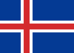
| Flag of Iceland | |
According to the ancient manuscript Landnámabók, the settlement of Iceland began in 874 AD when the Norwegian chieftain Ingólfr Arnarson became the first permanent settler on the island. In the following centuries, Norwegians, and to a lesser extent other Scandinavians, immigrated to Iceland, bringing with them thralls (i.e., slaves or serfs) of Gaelic origin.
Currency / Language
| ISO | Currency | Symbol | Significant figures |
|---|---|---|---|
| ISK | Icelandic króna | kr | 0 |
| ISO | Language |
|---|---|
| DA | Danish language |
| EN | English language |
| DE | German language |
| IS | Icelandic language |
| NO | Norwegian language |
| SV | Swedish language |


